Southwest Monsoon Advances Into West Bengal and Bihar — IMD Issues Wet Spell Warning for Northwest India
The Southwest Monsoon 2026 has taken another significant stride forward, advancing into more parts of West Bengal and Bihar as of June 12, according to the India Meteorological Department (IMD). Simultaneously, a western disturbance is bringing a wet spell to northwest India, creating an unusual situation where both the monsoon’s forward march in the east and unseasonal rain in the northwest are affecting millions of people across the country.
The IMD’s latest press release confirms that the monsoon has now covered the entire northeastern states, Sikkim, Sub-Himalayan West Bengal, parts of Gangetic West Bengal, and portions of Bihar, Odisha, and Jharkhand. The advance follows a broadly normal progression after the monsoon’s onset over Kerala on June 1 — right on schedule for the second consecutive year.
Current Monsoon Position
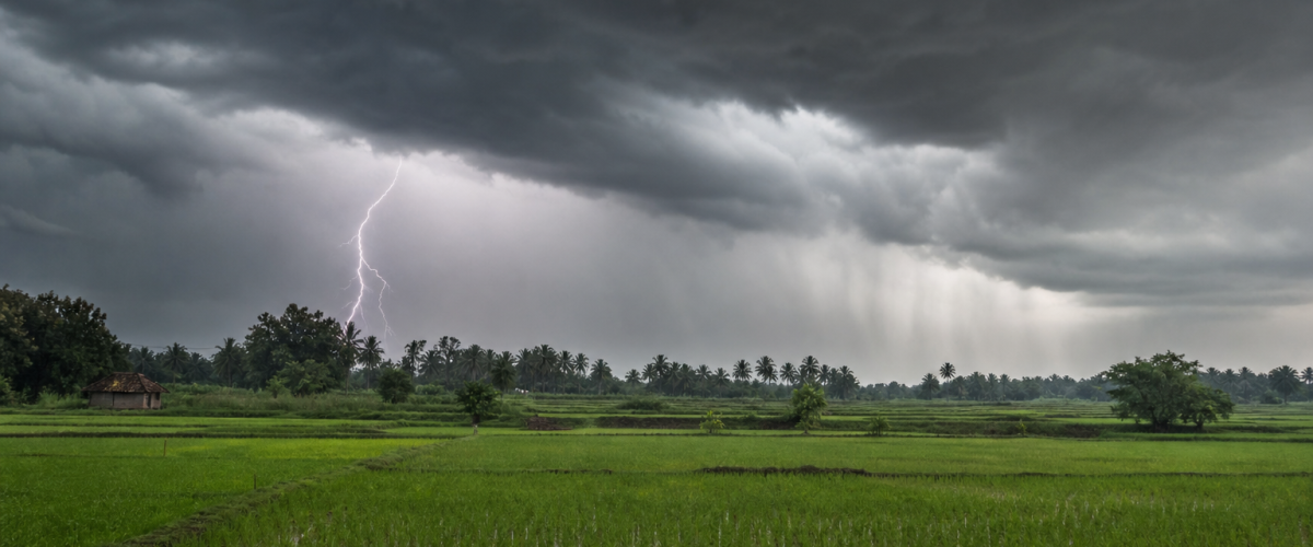
As of June 12, the Northern Limit of Monsoon (NLM) extends from Raigarh in Chhattisgarh through Chaibasa in Jharkhand, Haldia in West Bengal, Berhampore in Murshidabad, and further east through the entire northeastern region. The monsoon has established itself firmly over the Bay of Bengal arm, bringing sustained rainfall to coastal Odisha, Jharkhand, and the eastern plains.
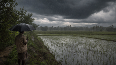
The advance into West Bengal and Bihar is particularly significant for agriculture in these states. The kharif sowing season depends heavily on the monsoon’s timely arrival, and farmers in Bengal and Bihar have been anxiously awaiting the rains to begin transplanting rice — the region’s primary crop. Early estimates suggest that the monsoon’s arrival is approximately 3-5 days ahead of the normal schedule in these areas, a welcome development for the agricultural sector.
Western Disturbance Brings Rain to Northwest
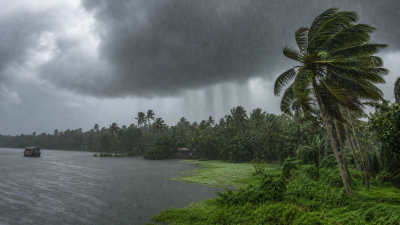
Adding to the weather complexity, a western disturbance has been active over northwest India since June 10, bringing scattered to moderate rainfall over Jammu & Kashmir, Himachal Pradesh, Uttarakhand, Punjab, Haryana, and parts of western Uttar Pradesh. The IMD has forecast that this wet spell will continue until June 13, after which the system is expected to weaken.
Western disturbances in June are not unusual, but their interaction with the approaching monsoon can create enhanced rainfall events. As the monsoon continues its northwestward advance over the coming weeks, these interactions could lead to intense precipitation episodes that carry both benefits (groundwater recharge, reservoir filling) and risks (flash flooding, landslides in hilly areas).
The IMD has issued specific warnings for Himachal Pradesh and Uttarakhand, where heavy rainfall combined with already saturated soil from pre-monsoon showers could trigger landslides and flash floods. Disaster management authorities in both states have been placed on alert, with rescue teams positioned at vulnerable locations.
Extended Range Forecast: June 11-24
The IMD’s extended range forecast for the two-week period from June 11 to June 24 paints a mixed picture. The monsoon is expected to advance further into remaining parts of West Bengal, Bihar, Jharkhand, and Odisha during the coming week, and could reach eastern Uttar Pradesh by around June 18-20.
However, the advance into northwest India — including Delhi, Rajasthan, Gujarat, and western Uttar Pradesh — may be slightly delayed compared to the normal schedule. The IMD’s models suggest the monsoon could reach Delhi by around June 28-30, roughly on schedule with the climatological normal date of June 27.
Overall rainfall during the June 11-24 period is expected to be above normal over northeast India, East India, and the southern peninsula, while near-normal conditions are projected for northwest and central India. The Bay of Bengal is showing signs of cyclonic circulation development, which could enhance monsoon activity over the eastern seaboard in the second half of June.
Agricultural Implications
The monsoon’s arrival is the most critical weather event for India’s agricultural sector, which employs approximately 42% of the country’s workforce and contributes about 18% to GDP. The kharif season, running from June to September, accounts for nearly half of India’s total foodgrain production.
Rice, the dominant kharif crop, requires sustained rainfall during the transplanting period (June-July) for optimal yields. The monsoon’s timely arrival in West Bengal and Bihar — two of India’s top rice-producing states — bodes well for production forecasts. Similarly, the rains will support the sowing of pulses, oilseeds, cotton, and sugarcane across central and western India as the monsoon advances further.
However, the distribution of rainfall matters as much as its timing. Excessive rainfall in short periods can damage standing crops and prevent sowing, while prolonged dry spells within the monsoon season (known as “monsoon breaks”) can cause severe moisture stress. The IMD’s seasonal forecast has predicted normal to above-normal monsoon rainfall for 2026, which, if realised uniformly, would be beneficial for agricultural output and overall economic growth.
Dam and Reservoir Status
The Central Water Commission’s latest bulletin shows that water levels in major reservoirs across the country are currently at approximately 28% of total capacity — close to the long-term average for this period. The monsoon rains over the coming months will be crucial for filling these reservoirs, which supply water for irrigation, drinking, and hydroelectric power generation.
Key reservoirs in southern India, including those in the Krishna, Cauvery, and Godavari basins, have benefited from the monsoon’s early advance and are already showing improved inflows. Northern Indian reservoirs, particularly those in the Indus and Ganges systems, will begin filling as the monsoon reaches their catchment areas in late June and July.
As the Southwest Monsoon continues its northward journey, the coming two weeks will be critical in determining the season’s overall character. For now, the signs are broadly positive — but as any Indian farmer will tell you, with the monsoon, nothing is certain until the fields are green and the reservoirs are full.
Also Read
- India’s Monsoon 2026 Forecast Drops to 90% of Normal — El Niño Threatens Agriculture and Economy as IMD Issues Below-Normal Warning
- Super El Nino 2026 Threatens India Southwest Monsoon as IMD Forecasts Below-Normal Rainfall and Drought Risk Looms Over 60 Percent Farmers
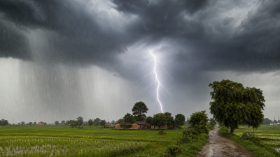
- Southwest Monsoon Reaches Bihar — Lightning Kills 5 in Khagaria as IMD Predicts Rapid Advance Across Eastern India
- Southwest Monsoon 2026 Advances Into 12 States — IMD Issues Red Alert for Coastal Karnataka, Heatwave Grips North India
- Southwest Monsoon to Hit Kerala Around June 4 as IMD Confirms Onset — What It Means for India’s Agricultural Season
- India Showcases AI Leadership as Official Partner Country at VivaTech 2026 in Paris - June 17, 2026
- India Bans Telegram Before NEET Re-Test; CEO Pavel Durov Accuses Reliance of Global Sabotage - June 17, 2026
- Southwest Monsoon 2026 May Be India’s Weakest in 11 Years — IMD Issues Heavy Rain Alerts Across 8 States - June 16, 2026